Rolling out of Los Alamos at the bright-and-early hour of 10am, I realized two things: First, that it was a day to find little, wiggly roads I’d never taken before, and second, that I’d forgotten my toiletry bag. I was already going forward, however, and at times like that I’m quite simply incapable of turning back. Stopping for gas in Totavi was difficult enough.
It was not a day for driving with the top down. The first significant showers hit as I was passing Cuyumunge, but it was a small storm cell and I was through it quickly. I took a right turn at Albuquerque but only stayed on the Interstate until the turn-off for Quemado.
I’ve been through Quemado plenty of times (haven’t we all?) but only going east-west on Highway 60. Today, for the first time, I decided to take the little north-south highways down through the last echoes of the rocky mountains, the spine of the continent.
Immediately I knew I’d made the right choice. I had NM 117 almost entirely to myself, except for the State Police cruiser I passed almost right away. A good reminder that today was about the road, not the destination. No need to hurry.
As I crossed the continental divide I had a massive storm feeding the Atlantic off to my right, lightning flicking and flashing with abandon (thunder in my little world provided by Social Distortion), and ahead a smaller but no less electric storm dumping into the Pacific. The latter would be my host for the last few miles into Quemado.
After a brief fluid-related stop in Quemado, where I had a pleasant conversation with a local, mostly about the weather, it was further south on NM 32. That was a fine bit of roadway right there, and hopefully next time it won’t be bucketing on me so hard I can’t look anywhere but the road. Cruising down a narrow canyon by Apache Creek was especially nice, and exceptionally rainy.
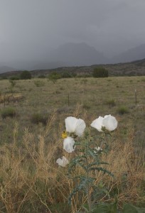
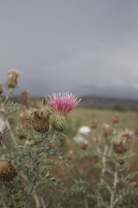
After the signage confused me a bit in Reserve (roads that don’t show up on my maps accompanied by a turn that felt like I was going in the wrong direction), I got myself on US 180 for another southward leg. It was only sprinkling off and on, and I had a little more attention for the world around me. After I came through something-or-other pass (elevation six thousand something) I started to notice patches of white flowers along the roadside, sharing space with purple-blossomed thistles. The white flowers looked like poppies as I motored past. Very pretty.
There is a section of US 180 past Glenwood that is a) Under construction and lacking all markings, and b) 35 mph speed limit. I, in my “what’s the hurry?” attitude, was doing 55 mph along there just to keep the people behind me from running me over. Then it started to rain. Did I mention the rain before? Yes? Well, that wasn’t rain. This was rain. Lashing, blinding, dumping, end-of-the-world rain. No stripes on the road to key on. I slowed down, and those behind me (who had tail lights to track) got even closer.
The good thing about those really intense storms in the mountains is that they are relatively compact. Soon after the twisty-curvy by Braille was over there was a turn-off for a scenic view, and I took advantage. I did not want to see any of the people who had been behind me again, ever.Along the road up to the overlook there were more of the white flowers. I stopped and took a couple of pictures, but I was standing in the rain and didn’t have the patience to get the really good shot. I did notice, however, that despite the petaled, poppy-like flowers, the stems were bristly and stiff like a thistle. Perhaps I was looking at some Frankensteinian hybrid of a gentle garden plant and a thug from the wrong side of the tracks, botanically speaking. (If I were in charge, the plant would also be able to uproot itself and shoot poison darts. I saw no evidence of these abilities today, however, so there’s no need to panic… yet.)
Not far south of the rest stop was a turnoff I’d been debating. NM 78 broke off the “big” road and headed west into Arizona. I was still enervated from the previous downpour adventure, but I decided to give the little road a go.
When I turned onto 78, there was a sign reading, “Steep grades and sharp curves. Trucks not recommended.” Music to my eyes.
I hadn’t got far when I saw the battered old pickup some distance ahead of me hit the brakes. Hm. I got closer and as i came over a rise saw what he had. There was a pretty decent river flowing across the highway. Still, an old pickup got through, so why should someone in a low-slung sports car worry? With all due caution (I have a friend who lost his engine to high water), I forded the river, came out the other side in second gear with a sigh of relief. On I went, but not very far before I encountered the next river. I noticed that where the river flowed off the pavement on the downstream side there was a pretty significant dropoff, with a waterfall I might have appreciated more if the Bronco coming the other way weren’t trying to get over on my side to avoid a big rock. We all got through just fine in the end, Mr. Bronco waited for me to pass. Good thing, too, because I didn’t have a free hand for the window control.
The four fords went something like this:
- Holy cow! I hope I can get through this.
- Stay calm, take it easy.
- Don’t get cocky, sport; that kills engines
- I should have my camera ready for the next one.
Of course, there was no next one, but I did manage to get my phone ready for pictures just in case. From there 78 became steeper and I made a note to add this little ribbon of asphalt to the list of the best drives in the US. I suspect it would be better to drive it eastbound (better to be going uphill for the steepest parts), but my buddy in the pickup and I were treated to one heck of a beautiful and active drive.
Have you ever smelled a pine forest after a heavy rain? Something about the bed of needles on the ground (that’s my theory anyway) gives it a smell that is like no other. A little sharper than other forests. It’s incredible.Down, down, and more down, the sort of down that affects your mileage, on twisty-windy roads, trapped behind trucks pulling camping trailers, but that was all right. As we came out of the mountains I almost stopped at a wide spot on the road that had one of those desert views, where you can see across multiple time zones, and you can see the rain falling over there and the sun shining on that mountain and a hell of a lightning storm off to the north.
Did the Navajo think the Earth was flat? What about the Apache? Seems like a question we need answered.
At the bottom of AZ 78 I was faced with a choice. I pulled over for a moment and consulted my not-very-good road atlas. (My previous was Rand McNally and was much better.) I decided on US 191 all the way down to Interstate 10. As I mototed along the flowers gave way to succulents. An occotillo-like plant a vivid green against the red clay. Yuccas and either skinny barrel cactus or stunted saguaros. Cholla and woody shrubs in the overgrazed areas (the contemplation of which triggered a get-poor-quick scheme for another day).
(Note to self: If I ever need a good movie location with an impressive bridge with no traffic that we could maybe even blow up, there’s one next to Highway 191. Ample parking.)
I rejoined civilization in Safford, AZ, a farming town and then some. Not sure, but it might have been cotton in those flooded fields. Safford seemed like a nice place on my flyby, with a sense of community if the signs for this and that event are to be believed. After my high-altitude excursions, however, I could really feel the heat.
I stayed true to my highway headed due south of Safford. On the stretch between Safford and Interstate 10 I saw three things that I claim are thematically related. Just don’t ask me what the theme is.
I saw decay. The human settlements along that stretch of road had obviously seen better days. Even some houses that at 60mph looked like they had been pretty nice once lay abandoned. There were still plenty of people living there, but whatever had been supporting that community is gone. A ghost town in the making, populated only by people with nowhere else to go.
I saw plenty. The yuccas’ long stalks were bent over, forming weary arches. At first glance this is in harmony with the human plight of the town, until you realize that the plants are bowed over by the weight of their own fruit. The yuccas, at least, seem to be doing well this year.
I saw waste. For most of the way south, US 191 is a simple, well-maintained stretch of two-lan blacktop. Then, without any change in circumstances, there is a section that is divided highway, and then a section of perfectly adequate two-lane again, and then back to divided highway. I’m sure someone somewhere can tell me why it’s critical that US 191 be upgraded, but seriously, I’m not buying. I thought at first I was looking at stupidity, but then I realized I was most likely looking at the price tag for the vote of a powerful senator on some other issue. “We’ll send one hundred million of other people’s dollars to Arizona if you vote for…”
If you study those three observations long enough you’ll see an important convergence, a glistening polyp of knowledge that will make this whole crazy thing called life make sense. When you find it, let me know, ok?
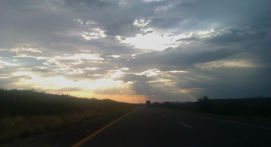
Freeway! High speeds (except where there’s construction)! The entertaining route is rarely the fastest one, and there was still a long way for me to go. I was already exceeding the speed limit when I hit the top of the on-ramp. Time to fly!
Only, directly ahead loomed a big-ass storm. We’re way in the south of Arizona at this point, right? This desert could eat your pisante desert for breakfast, and wash it down with a glass of burning sand. Yet there in front of me is a rainstorm. Careful readers of this blog, those who keep score and try to catch my continuity errors, will note that the last time I drove this stretch of road, it was a white-knuckle gullywasher experience. That time I found myself in an America’s Best Value Inn, and likely that will be my last time with that chain. It sucked and cost a lot.
This time the plan was to fly Best Western. In the days of my months-long road trip they were the most likely to have Internet access, and that made me a fan. Right now they’ve got a buy-two-get-one-free special working. I hope to figure it out. Anyway, I was thinking, as I approached this storm, that if I saw a Best Western sign then my day was done.
I saw one such sign, in Hickox (Willcox?), and got off the freeway. I navigated the flooded roads for a while, never spotting the promised hotel. Finally, I saw the tall standard in the shape of a Best Western sign, empty. The hotel has apparently severed ties with my preferred chain. I drove on, into the mouth of the storm.
It was all pretty much routine, except when I was passing a truck, with a car in front of me, when we all together hit a section of the pavement where the water sheeted up. I never lost traction, but I was completely blind, all the glass of my car completely covered by torrents of water. Somewhere to my right was a big-ass truck. To my left, the median. Ahead, who knows? What if that driver hits the brakes?
My first fumbling act was to flip the wiper speed lever up to full blast. It wasn’t until several seconds later, the crisis passed, that I even realized I had done that, for the effort was completely futile. Water was dumping on me far too quickly to be wiped away.
I tapped my brakes, partly to send a signal to people behind me but mostly just to know they worked. I clenched the wheel, invented newer and better curse words than have ever been uttered before, and forgot them. Then we were through the crisis, all still alive, and slowly I got my heart under control.
Total time elapsed: maybe fifteen brick-shitting seconds.
That’s the thing about the road. It doesn’t care how much you love it. It’ll kill you anyway.
Now I’m at a Motel 6 in Casa Grande, Arizona. It’s nice enough, and it’s cheap. (Not as cheap as the hotels in Tucson, though. Those who plan their trips should try to sleep there.) Internet is extra here, but my phone can get me some Internet love. Tomorrow I’ll put up the photos. I bought a toothbrush and toothpaste at the truck stop across the street.


